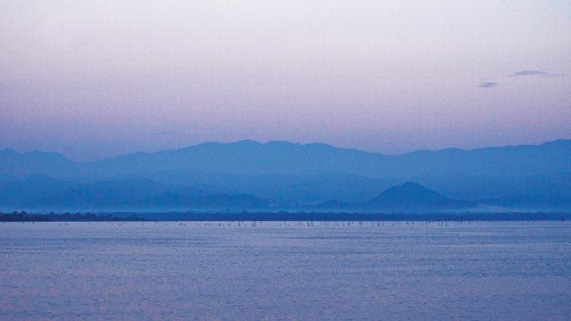
The Walawe basin nestling in the part of the Ratnapura, Hambantota and Moneragala districts is adorned with many tourist attractions. Among them, the most popular attractions are the Uda Walawe reservoir and its adjoining Udawalawe National Park. Having crossed over this reservoir embankment on many occasions during my visits to southern and eastern destinations, I take a peek into this magnificent work of irrigation engineers of years gone by.
It was a great moment in the history of the irrigation sector in then Ceylon in the latter part of 1950, when former Prime Minister, the late Sir John Kotelawala inaugurated work on the Walawe Ganga reservoir scheme, the second multi-purpose project undertaken in Ceylon after the country gained Independence.
The 138 kilometre long Walawe Ganga is one of Sri Lanka’s largest rivers. It enters the sea on the southern coast near the Godawaya estuary in Ambalantota, 20 kilometres west of Hambantota. It is watered by the rains that fall on Horton Plains, which in turn feeds the beautiful stream that flows beside the Belihuloya Rest House.
The famous Haputale Gap and the Pass are also in the hinterland of its watershed as are all the hills, valleys and tanks that you see as you climb Haputale Pass form the rain collecting area of Walawe Ganga. What you see from this Pass are the land, partly jungle, tea, paddy and chena cultivations.
All the rain that falls in this area finally finds its way to the Walawe Ganga and then to the sea at Ambalantota. In a year as much as 1,150,000 acre-feet of water flows into the sea and with it much of our top soil. The leaders in that time thought if this water can be used to irrigate lands and generate hydro-electric power, it could produce much power to light houses and work the machinery of factories.
The site selected by the Irrigation Department engineers was located in a small village called Embilipitiya, on the road from Pelmadulla to Ambalantota. Today, Embilipitiya has blossomed into a bustling town, where the sprawling lands are filled with rice fields, industries and multitudes of farming communities.

At this point the river that had its rise at Belihuloya, Horton Plains and Haputale Pass, enters the plain through a narrow valley, which offers many advantages for the construction of a dam.
Since the river receives an unfailing annual supply of water, the Irrigation Department engineers have decided to hold the water here and irrigate the lands below for growing paddy and other crops such as sugarcane and chili. As the same time, engineers planned to generate 6,000 KW of electric power for distribution in the surrounding countryside.
The entire engineering enterprise was no small task. At the Embilipitiya project site the river was dammed by an enormous earth embankment 100 ft. high at the river section and 17,000 ft. long. This earth embankment was so huge that it carried a road atop wide enough to take two lanes of traffic and sufficient room for parking. A dam of about three kilometres impounds the water of Walawe Ganga and the reservoir covers 3,413 hectares.
The earth embankment was not safe unless there was a means of directing the floods or surplus water over it. For this purpose, the engineers have provided a concrete dam in the central section of the earth dam. This massive concrete structure is 1,000 ft. long and 120 ft. high.
To pass the flood water there were nine radial gates, each 40 ft. long and 30 ft. high, which can be raised and lowered from a bridge on the top of the concrete structure. When these gates open, as much as 260,000 cubic feet of water per second can be passed from the reservoir to the river below.
On the right bank of the river and the right-hand end of the concrete dam is the power house, which converts the energy in the flowing water into hydro-electric power. This water, after passing the turbines is passed on to the ‘Yoda Ela’ (literally big canal) to take the water far out to irrigate the land commanded by the ‘Yoda Ela’. Some of the water from the turbines is passed back into the Walawe Ganga to be picked up at the Liyangastota anicut, which was constructed nearly a century ago to feed the channel system under this scheme.
However, in 1986, downstream of Belihuloya near Pabahinna, another massive reservoir was built damming the Walawe Ganga under the Accelerated Mahaweli Development Scheme known as Samanalawewa Reservoir to generate hydro-electric power.
A great irrigation tank like this Uda Walawe reservoir, its catchment area and the vast virgin forest land has to be preserved and conserved in the veritable name of nature for posterity. Its vast imprisoned waters have to be preserved for its prime environment. The area also has to accommodate elephants that were displaced by the irrigation development under the Uda Walawe reservoir.
With all those splendid hopes of conserving the reservoir and its catchment area the present Uda Walawe National Park was declared as a National Park by a Government Gazette notification on June 30, 1972. Today, it is a paradise for wildlife and the best spot to observe Asian elephants in the wild, at any time of the year.
