


 The decades-old land dispute in Kankesanthurai has reignited tensions between local villagers and Buddhist temple authorities, raising serious concerns about the validity of both parties’ claims.
While the temple asserts a historical and religious right to the land, supported by ancient chronicles and recent maps, villagers maintain legal ownership backed by land deeds dating back nearly a century. Amid these competing narratives, the Sunday Observer set out to uncover the truth—delving into archival maps, historical records, expert opinions, and testimonies from those directly affected—to understand the real story behind the land claimed by the Tissa Maha Vihara.
Historical facts
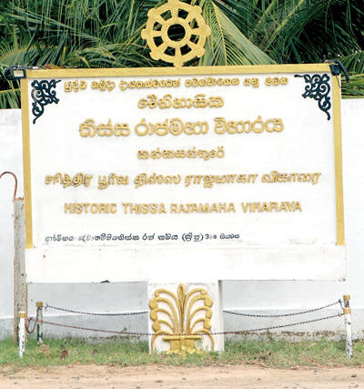
Investigations, including interviews with prominent Sri Lankan historians and archaeologists, confirm that Tissa Maha Vihara is among the ancient Buddhist sites chronicled in the Mahavamsa, the island’s revered Pali chronicle. According to this source, King Devanampiyatissa constructed three temples in “Nagadeepa” (now understood to mean the entire Jaffna peninsula) some 2,250 years ago: Jambukola Vihara (at Madhakal), Tissa Maha Vihara, and Pachinaramaya Vihara.
Though the Mahavamsa blends myth and history, few Sri Lankan historians dispute its archaeological echoes, and further evidence supports the existence of a major temple complex in the area: Mudaliar S. Rajanayakam, in Ancient Jaffna (1926), references a Kandaswamy temple in this vicinity, suggesting prior religious structures existed around what is now called Tissa Maluva.
The modern discovery occurred in 1946, when bhikkhus Kalutara Sheelathara Tissa Thera and Gautara Pannantha Thera identified a ruined Bodhi tree, leading to the establishment of a small pansala (shrine). That same year, a devotee named ‘Abraham Perera’ donated 1.25 acres of land to support the new shrine. He donated that plan to the ‘Nagadeepa Vihara.’ Violence in the late 1950s and the civil war that followed led to the temple’s abandonment. However, historical evidence resurfaced in a 1959 Jaffna map, depicting the temple occupying around 15 acres. (Image 01) – This map is widely shared everywhere. To get more details and for a fact check, the Sunday Observer went to the Survey Department to investigate this. When we first showed this 1959 map, Senior Superintendent of Surveys S. Samarasinghe said that it was not a map drawn in 1958, but that the British had gone all over Sri Lanka from 1896 to 1924 and had collected information and then drawn the complete map of Sri Lanka. He also said that the maps has been updated since then, and he assumed that this map could have been updated later, but clearly said this was not drawn in 1958.
The former Surveyor General, P. M. P. Udayakantha, outlined how Sri Lanka’s mapping system has evolved: “The British mapping system, the ‘one‑inch to the mile’ (1:63,360) scale, was converted to the metric scale of 1:50,000 in the 1980s. The old mapping was created by British surveyors who visited and observed the locations directly. When the country adopted the metric system, the new 1:50,000 maps were produced based on those British originals, enhanced with modern satellite technology.” He said, “Importantly, the British maps included data on ancient historical sites. Today, we update the 1:50,000 metric maps about every five years. All this information is available through the Survey Department.”
Uncovering historical maps
To verify the widely shared maps circulating on social media and to confirm whether the temple existed before 1945, the Sunday Observer approached the Survey Department, which releases maps to the public and is the oldest Government department in Sri Lanka.
We asked the officials there for an old map of the Kankesanthurai area, as all citizens normally obtain maps of Sri Lanka for their needs. Then they said that there were threats to national security by releasing it, and they asked our reporter to write a letter to the Survey General, after which they could consider releasing the said map. They also said that even the Military and State Intelligence Departments had previously inspected the same maps. So there is a Concern.
Undeterred, we submitted both the required letter and a formal Right to Information (RTI) request, seeking official clarity. Our next stop was the National Archives, where our efforts paid off. We discovered an original Survey Department map of Jaffna, completed around 1902–1903 and revised in 1924. Importantly, this early map showed no temple marked in the Thaiyaddi area, calling into question claims that the temple predated the mid-20th century.
 However, there is a very clear mention of the Catholic church and the Hindu Kovil that still exist in the same place today. We also examined the 1:50,000 metric scale maps published between 1978 and 1996, which were based on an earlier British “one-inch” maps. Even these modern maps contained no indication of a temple at Thaiyaddi, further suggesting the site had been unused for decades. This raises many more questions!
After the war ended in 2009, restoration efforts began: In 2017, during the ‘Yahapalanaya’, then-Governor, Reginald Cooray laid a foundation stone on the original 1.25-acre site, though no building followed. In 2021, under President Gotabaya Rajapaksa, Commander Shavendra Silva, with the support of the army, laid another foundation stone 100 metres Northwest of the initial site. Today, the temple stands within a seven-acre ground. Also, the temple authorities said that according to the 1959 map, they own 15 acres of land. But the original 1.25 acres, where the temple’s original land, which was gifted by Abraham Perera in 1945, is not being used. Sixteen affected landowners now say that this fenced boundary includes additional public lands and private properties. According to both Survey Departments’ original map, it says those lands do not belong to the temple. It can be concluded that the map, which is considered to be a map issued by the Survey Department in 1959, may have been an updated map that included the temple built at that location after 1945.
However, it is wrong to say that the place belongs to the temple solely, because there is a large image of a temple at the location mentioned as the temple on that map. We believe that the Sri Lanka Survey Department has all the information in this regard, and they should take steps to provide it accurately. As long as they keep it hidden, this problem will not only worsen but will not be solved.
Valid land deeds
Historic records and census data paint a different picture of Kankesanthurai than the one often portrayed in recent disputes.
According to the 1981 census, the Kankesanthurai Divisional Secretariat was home to 380 Sinhalese and 370 Buddhists, and it even hosted a Sinhala Maha Vidyalaya (school). A notable Sinhala community, many working in the cement factory, port, and operating bakeries, coexisted with local Tamils, and inter-ethnic marriages were also reported.
The temple’s supporters have repeatedly accused villagers of fabricating land deeds. To investigate, we reviewed those deeds and consulted with several legal experts specialising in land rights. They confirmed that the deeds are genuine. One deed, for instance, dates back to 1928, making forgery highly unlikely, as they said, precise details of granting parties and recipients “wouldn’t appear so clear if they were falsified.” Yet, despite these authentic claims, landowners hesitate to pursue legal action.
The people again gave the same answer. “The court’s previous verdicts in similar cases made us even more afraid. Even though there was similar evidence from land deeds, in some cases, the judiciary has ruled in favour of the opposing party due to two important issues: national security and Buddhism. Therefore, we still believe that if we approach the relevant authorities and state our case without going to court, we will get a solution,” they said.
Residents also voiced procedural concerns: “Government officials and even police first go to the temple to worship the Thera, eat there, before speaking to us. Many don’t even speak our language. How can we trust them to deliver justice when they’re so influenced by religious rituals?” These realities expose a troubling imbalance, where the claim of religious protection and fear of legal channels perpetuate a cycle of grievance and injustice.
Sacred texts vs. land deeds
Since the day the controversial temple structure emerged on disputed land in Thayaddi, local residents have been continuously protesting, demanding the return of what they say is rightfully theirs. These protests, grounded in concerns over land ownership and displacement, have garnered support from human rights activists, local civil society organisations, and even elected representatives. At the heart of the conflict are two competing claims: On one side, Buddhist organisations and temple representatives assert that 15 acres of land mentioned in a 1959 map belong to the temple.
When asked for official documentation to support their claim, they declined to present written evidence. Instead, they cited historical and religious sources such as the Mahavamsa, the book Ancient Jaffna, and an undated inscription allegedly discovered at the temple site. On the other side, Tamil residents claiming the land as theirs have produced formal land deeds, some of which date back nearly a century. Their legal ownership is supported by documentary evidence and has been verified by land rights experts. Amid this contested terrain, Jaffna District Member of Parliament from the National People’s Power party, Ilangumaran, acknowledged the growing urgency of the situation. In a statement to the Sunday Observer, he said: “It is now possible to provide justice to these people. The Minister of Justice is taking all necessary steps for this. Recently, our Government has reached a negotiation with the landowners through online dialogue. The Government is confident that a fair decision in favour of the landowners can be reached within a month without causing any problems.”
He also said that some local politicians are attempting to exploit the land issue for personal political gain, and added that this must not be allowed to interfere with a just resolution. The land belongs to the people. We presented all the documents and facts to a respected and prominent historian and archaeologist asked for his view on the issue. After carefully reviewing the evidence, He said that he knew everything when this problem started: “This temple has been built on land that rightfully belongs to the local people who used to live there. Losing land causes deep pain, and I understand their suffering.
The Department of Archaeology and the Ministry of Buddhism must take full responsibility for what has happened. They still have the power to intervene and offer a fair solution. However, demolishing the newly built pagodas could be dangerous and may spark fresh conflict. The best option is to leave the temple as it is, but return the remaining land to the rightful owners. If needed, the Government can provide the people with alternative land of equal value.”
He also said, “Using modern technology, it’s possible to trace the exact location of the temple mentioned in the Mahavamsa. If this is done, it will show that the claims about this site are false. I personally know that the original ancient temple is located elsewhere near the sea, and is now being destroyed by erosion. Yet no one is paying attention to that.”
“What’s happening here is that innocent people are being made to suffer, and unnecessary ethnic tensions are being created. All of this is happening because an illegal temple was built on civilian land with military support to serve political goals,” he said. Through field investigations, historical map analysis, official records, expert legal reviews, and direct testimony from affected residents, it is now evident that the land in question belongs to the people who have lived there for generations.
From colonial-era deeds dating back to 1928, to national survey maps from 1902 showing no trace of a temple in the disputed area since 1945, the evidence overwhelmingly supports the villagers’ claims.
As tensions simmer and public attention grows, recent statements from Government officials suggest that a resolution may be on the horizon. With the Minister of Justice actively engaging with affected landowners and discussions already under way, there is cautious optimism that a fair and peaceful settlement can soon be reached. If officials follow through on its commitment to justice and transparency, this long-standing dispute—rooted in historical ambiguity and present-day grievances—could finally find a resolution that respects both religious sentiment and the legitimate rights of the people.