According to the Mahawamsa, a city named Uruvela was built by a minister of Prince Vijaya, 8 yodunas (40 miles) West of Anuradhapura. Fishermen of Uruvela had gifted pearls and corals when King Dutugamunu was building Ruvanweliseya. It also mentions that Uruvela was a harbour town close to the pearl banks. Pearl banks are between Kudiramalai and Mannar.
In the 3rd century A.D. map of Sri Lanka by Ptolemy, the famous Roman Historian, a town named Margana is prominently marked close to Kudiramalai. After his research on “The Ports of Ancient Ceylon” by B. J. Perera, is of the view that Margana is the port city of Uruvela.(Ceylon Historical Journal vol.1),but the site of this city has not been located. Like Uruvela, there are other cities mentioned in the Mahawamsa, i.e. Vijithapura, Tambapanni Nuwara, Ujjeni, and Upatissagama which are not located hitherto. Recent excavations near Polonnaruwa new town, at a village named Kaduruwela have tentatively found the Vijithapura fortress. Readers could Google for “ruins of Kaduruwela” for details.
R.L. Brohier, the famous surveyor, geographer, writer and Archaeologist in his book in 1973 “Discovering Ceylon” mentions that, Surveyor G.H.A. de Silva while surveying the Northwestern coast of Sri Lanka for the Survey Department found a site with ruins, a natural harbour and three ancient wells, which he marked it on his map in 1923.
Brohier subsequently visited the site of the ruins which was about 4 to 5km South of Kudiramalai and extending for about 500 metres along the sea shore, between two migrant fishing villages, namely Palkathurai and Kollankanatte. Brohier found a large number of ancient bricks which were like the bricks found during excavations at Tissamaharama by Henry Parker, the famous British Archaeologist. Some pieces of pottery obtained at the site of the ruins date back to around first century B.C.
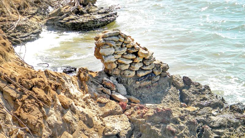
First century pottery ruins
Dr. Shiran Deraniyagala, the famous Archeologist, has also examined the pottery of these ruins and is of opinion that it dates back to first century A. D. and is like the pottery found during the excavations at Anuradhapura. Brohier also mentions about the three ancient wells and the discovery of many household goods like cooking utensils, plates, water containers which were found embedded between the surface sand layer and the coral layer beneath. These items have been sent to the Archaeological Department, but to date no reports are available. Any reader who is interested in these ruins could refer the book by R.LBrohier named earlier.
After reading Brohier’s book, I and two of my friends wanted to visit these ruins. A class mate, Edmond Wilson, a retired Game Warden of the Wilpattu National Park said that he knew the site of the ruins. Accompanied by two serving Game Wardens of the Wilpattu National Park, we entered the beach at the migrant fishing village of Kollankanatte and proceeded towards Kudiramalai along the sea shore as it was very difficult to go through the jungle. After walking for about 300 to 400 metres we were surprised to see large buildings being eroded by the waves. Some buildings were in the sea close to the shore.
The three wells mentioned by Brohier were not seen and we were informed that they were washed away by the eroding waves. The walls of some buildings were made of limestone, bricks, and corals were about 2 feet thick. Brohier may not have seen most of these buildings as they were possibly not exposed by the eroding sea at the time.
There were lots of broken bricks scattered along the sea shore in addition to broken household items seen between the surface sand layer and coral layer beneath. I took photographs and met the then Commissioner of Archeology, Dr. Senarath Dissanayake, to show the photos and other data which I had gathered.
He then sent a team to conduct an Archaeological survey of a stretch of beach 20 metres from the sea shore, from the opening of Kalaoya (river) to Kudiramalai. The ruins mentioned by me between Kollankanatte and Palkathurai were also investigated, and the conclusion was that there had been a large ancient settlement. The report states that according to documents available, these ruins are in ancient Uruvela. The report also adds that according the Mahawamsa, a vehera named Valli vehera was built by King Suba in Uruvela, in the first century A.D.
Archaeologists, while doing an archaeological survey of the Pomparippu ancient burial grounds, close to Kudiramalai, found a ruined vehera. Among the ruins, an inscription stone was found bearing the name Valli Vehera. The distance from this Vehera to the ruins is only a few kilometres. This again confirms that these ruins are in ancient Uruvela. At Kudiramalai, an ancient Hindu Kovil and the remnants of a statue of a large horse were also found. Other archaeologically important structures were also found within the Wilpattu National Park during the survey.
History and legends
Kudiramalai, the famous ancient port city is between Mannar and Puttalam and in the Wilpattu national park within the Northern most part of the Puttalam district. The natural harbour of Kudiramalai opening into the Gulf of Mannar is world famous for its pearl banks and was named “Hippuros” by the Greeks.
The Northwestern area of Sri Lanka was under the control of the Malabar kingdom of South India during certain periods of time before the advent of Prince Vijaya. Indian history mentions about a Malabar Queen by the name Alisarani or Alisabrani who ruled from her capital Kudiramalai. She had traded horses for pearls with Arab merchants. Pearls were obtained from the pearl banks nearby.
The word Kudiramalai in Tamil means “Horse Mountain”. Her palace and settlement were close to the Kudiramalai hill. The Roman historian “Pliny the elder” mentions Hippuros harbour and a settlement close to Kudiramalai. Could the ruins mentioned earlier be the palace and settlement complex of Queen Alisarani? Legend has it that a cyclone or a tsunami had subsequently destroyed this palace and settlement complex.
Kuweni is thought to have ruled from Kudiramalai and the area was called Kali villu. There is a villu named Kali villu close to the ruins of a large building and legend says it was the palace of Kuweni. Visitors to the Wilpattu national park often go to see these ruins named ‘’Palace of Kuweni”. But Archaeologists are of a different view that these are the ruins of a Buddhist temple complex.
Tambapanni
Prince Vijaya is supposed to have landed close to Kudiramalai. After landing, he and his companions were resting on the beach and found their hands were copper coloured and named the area “Tambapanni”. The sand around Kudiramalai is copper coloured due to the high iron content of the sand.
It is possible that Prince Vijaya landed close to Kudiramalai. People of the area still use Tambapanni to indicate this area. According to the Mahawamsa, Prince Vijaya built a city on the banks of a river, close to the area of landing. Since Kalaoya opens to the sea close to these ruins, could these ruins be the Tambapanni Nuwara built by Prince Vijaya?
In ancient times, the area between Mannar and Puttalam was a highly populated and developed area, specially Mannar and the surrounding area. The ancient port of Mannar had been a world famous international harbour, while the port city of Uruvela may have been a world famous pearl exporting centre. The pearl banks, close to Kudiramalai had contributed a lot for the prosperity of the area.
The ruins of this civilisation are buried in the sand and covered by the Wilpattu jungle. It is possible that this region was the first developed area in Sri Lanka and in fact preceded the development of Anuradhapura. Very little Archaeological excavations have been done in this area to verify this important historical fact.
The ruins I mentioned according to evidence are most likely to be the ancient Port city of Uruvela, also the possible palace and settlement of Malabar Queen, Alisarani. Or could it be Tambapanni Nuwara, the first city of Sri Lanka?
Only archaeological excavations will reveal what exactly these ruins are. As, in a few years, these ruins will be washed away into the sea, the opportunity to establish an important feature of the country’s history may be lost forever. Ground penetrating radar, satellite imagery and modern methods of archaeology used in other countries will help uncover these ruins.
The writer is a Consultant Paediatrician.
