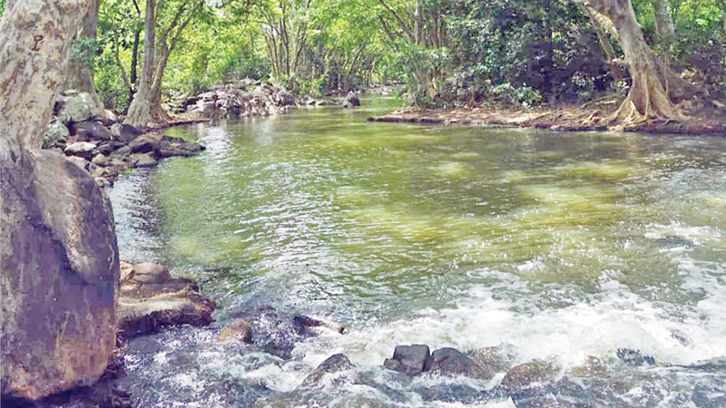
Kala Oya is one of the longest rivers in Sri Lanka, and it is most famous because of the Kala Wewa built across it. Although Kala Oya is of significant importance, it seems that most people do not know much about it, which distributes water into several other tanks and joins the sea near the Wilpattu forest.
Kala Oya is stated in the chronicles as ‘Gona Nadi’. It starts from the area around the Omaragolla hills close to Dambulla, reaches several tanks, and finally the Kala Wewa. Then it joins Mahaweli waters, flows for more than 145 kilometres, and joins the Indian Ocean at the north-west coast. Water from Dambulu Oya and Mirisgoniya Oya also causes the water level of Kala Oya to rise.
Having started from the Matale District, and entered Anuradhapura District, Kala Oya ends its journey in the North-Western Province. It flows at an altitude of 600 metres from sea level, during which it supplies water to more than 600 tanks. Nearly 400,000 people living in the valley benefit from Kala Oya. Its catchment area is 1,800 square kilometres, and 3,200 million cubic metres of rain water joins Kala Oya through it. Only about 5 percent of the water capacity is released into the sea without being used.
The main tributary of Kala Oya is Dambulu Oya. It starts from Naula area and carries water to Dambulu Oya Reservoir and Kala Wewa. Mirisgoniya Oya also contributes a significant water capacity to Kala Oya. This stream flows near Dambulla city and then joins Dambulu Oya. Konitha Oya, Angamuwa Lunu Oya and other waterways that start around Katiyawa farming area eventually join Kala Oya. The longest tributary of Kala Oya is the Siyambalangamuwa Oya which joins it near Rajangana.
Kala Wewa is the largest reservoir built across Kala Oya. It was built by King Dhatusena (455-473 AD) who reigned about 15 centuries ago. It is mentioned in the chronicles that King Dhatusena, who built Kala Wewa, had created another 18 tanks. The king built Kala Wewa, integrated it with Balalu Lake and built a large lake embankment, which came to be known as the Kala-Balalu Lake.
The Rajanganaya Reservoir, which was built in the 1960s by crossing Kala Oya and constructing a 350-metre-long dam, has a capacity of 100.37 million cubic metres of water. The total area of cultivated land under it, spread over the borders of Kurunegala and Anuradhapura Districts, is 15,500 acres. Rajangana Reservoir has a maximum water capacity of 76,603 acre feet. In addition to supplying water to the crops, water is also distributed to the Neela Bamma anicut, Angamuwa Lake, Tumullegama Lake and Eluwankulama Lake. Distributing water to Rajanganaya Reservoir, Kala Oya moves ahead and flows next to Neelabamma anicut.
The Neelabamma anicut is 149 metres-long and seven-metres high, and was built across Kala Oya to supply water to the people of Puttalam District which belongs to the arid dry region. It is in Karuwalagaswewa Divisional Secretariat Division. Neelabamma anicut-based irrigation is said to be the largest farming colony in the Puttalam District. More than 750 farming families have been settled there, and they are directly benefited by Kala Oya.
Kala Oya water is taken from Neelabamma anicut into a canal that distributes the water, and about eight cubic metres of water per second is released through the canal, which is 12 kilometres long, and ends at Ottapalam Lake. The Neelabamma project provides water to about 2,000 acres of agricultural land. Passing Neelabamma, Kala Oya enters the Wilpaththu National Park. It flows about 35 kilometres along the southern boundary of Wilpattu and ends its journey at Eluwankulama area, and joins the sea.
Maha Kala Oya Reservoir Project is an irrigation project proposed for Vanathavillu Divisional Secretariat in Puttalam District. There are plans to build dams across Kala Oya at Ralmaduwa, which is located in the Wilpattu National Park, and another area, which is a little north of Vanathavillu. The proposed dam is said to be 6.5 kilometres long and 13 metres high, but no construction has been started yet.
Environmentally high biodiversity can also be seen in Kala Oya river basin. In order to make it an ecologically sensitive area, several organisations including those linked to the United Nations have come forward to grant financial provisions, and several projects carried under such projects are currently under way. There are 158,700 hectares of terrestrial land, 250 hectares of salt marshes, 630 hectares of mangrove systems, and 200 hectares of riverine forests belonging to Kala Oya basin.


